
Let’s get something straight: Sardinia isn’t really Italian. Sure, it’s legally part of Italy, there’s a ferry from mainland, and the gelato is decent. But culturally, historically and psychologically, Sardinia is its own planet. A rocky, sun-blasted, goat-haunted travel destination floating in the middle of the western Mediterranean. Sardinia is ancient, stubborn, slightly paranoid, and absolutely magnificent. Sardinia is the second-largest island in the Mediterranean. But it doesn’t feel Mediterraneanat all. The interior is all granite mountains, scrubby forests, and ghost towns.
The coastline? That’s what brings the tourists. Sardinia’s beaches are insane. You’ve got the Costa Smeralda with its glamour, Cala Goloritzé with its limestone cliffs, and Spiaggia La Pelosa, which might be the most beautiful beach in the world. But more on that later. Sardinia tourism is a weird beast. On one hand, the island depends on it, especially in summer, when the coasts fill up with Italians, Germans, French, and a few lost Americans who were looking for Sicily. On the other, many Sardinians resent how tourists treat the island like a summer theme park.
That’s why the vibe shifts drastically once you leave the beach. In the interior towns, the energy is quieter, more skeptical. Locals will warm to you, but only if you show respect. Sardinia is an autonomous region of Italy. On paper, that means special powers. In reality? Bureaucracy, underfunding, and resentment. Many Sardinians feel neglected, exoticized, or just ignored by mainland Italy. And honestly, they have a point. Some dream of full independence. Others just want Rome to stop treating them like a beach resort with shepherds. This relationship is really complicated.
Cagliari
When D.H. Lawrence began his trip to Sardinia in 1921, he viewed its capital city of Cagliari from the sea and compared it to Jerusalem, calling it “strange and rather wonderful, not a bit like Italy.” The city continues to leave a powerful impact to this day. The serene lagoons on each side of the city, which serve as home for flamingos, cranes, and cormorants, add to the city’s backdrop, which is crowned by its medieval core encased in a protective ring of Pisan defenses.
There are about 430,000 residents in Cagliari and the surrounding metro region. About 150,000 people live in the city proper, which is modest by international standards yet powerful. The Cagliaritani have a strange blend of stoicism and kindness. After directing you and warning you about jellyfish, they will immediately complain about the government. The city lies between the Mediterranean Sea and the Campidano Plain, with a mix of coastal and inland environments.
The most elegant nighttime promenades in Sardinia may be found in the center along Via Manno, which drops to the livelier Piazza Yenne and Largo Carlo Felice, where the majority of the shops, restaurants, banks, and hotels are based. More stores and bars may be found at the portside Via Roma arcades at the bottom of the town. The cathedral, the city walls with its two Pisan towers overlooking the port, and the archeological museum with its fascinating collection of Nuraghic statuettes are Cagliari’s main attractions, and they are all perfectly closeto one another. Roman ruins, notably a spectacular amphitheater, are also scattered around the area. Cagliari’s historic Castello quarter, on the hill above the port, is home to nearly all of the city’s attractions.
The highest religious positions of power, the nobility, and the government have historically been seated here. Steep alleyways and stairs, together with many free elevators, connect Castello to the rest of the city. The working-class neighborhoods of Villanova to the east and Stampace to the west are becoming gentrified. Looking south across the Mediterranean toward Tunisia, which is slightly over 300 kilometers away, Cagliari sits on the southern tip of Sardinia. Because of its location, it was an important naval and military center for the Romans, Phoenicians, and Carthaginians. Cagliari is bounded by the Gulf of Cagliari, also called the Gulf of Angels. It wraps around the city like a shield. Due to its important port, Cagliari was heavily bombed by the Allies in 1943.
After much of the lower town was destroyed, many residents took refuge in underground tunnels and caves, some of which are still accessible today. Cagliari is an example of how Sardinian culture differs from continental Italy. Although Italian is the primary language of daily life, Sardinian, or Sardu, is still spoken and preserved through cultural activities, particularly the Campidanese dialect. Cagliari is also a gateway as well. From here, you may go to the other parts of Sardinia, such as the eerie ruins of Nora, the cliffs of Villasimius, or the dunes of Chia. The airport in Cagliari is located at Elmas, which is 7 km northwest of the city. The terminal is five minutes’ walk from Elmas-Aeroporto train station. Cagliari is reachable by ferry from Sicily and the Italian mainland. Ferries to the Sardinian capital are available all year round from the ports of Rome, Naples, and Palermo. This slice of northern Sardinia doesn’t just sparkle. It shatters your expectations. The Mediterranean here isn’t blue, it’s biblical.
La Pelosa beach
There are at least twelve shades of turquoise we can’t even name, and they all blur into each other like melted glass. The sand here is finer than powdered sugar. This is La Pelosa beach, perhaps the most beautiful beach in the world. La Pelosa sits in Stintino, a fishing town turned tourism heavyweight, in the Province of Sassari. Over 1 million tourists stomped through here last year. A million. For a beach just 300 meters long and 60 meters wide. That’s not tourism, that’s more of a siege. The water is so calm, so flat, so crystalline, it makes the Caribbean look murky. Why? Because the seabed is ultra-shallow and made of quartz-rich sand that reflects light like a stage spotlight. You can walk 100 meters into the water and still be waist-deep. No currents. No undertow. A literal sea pools. La Pelosa is backed by Capo Falcone, a wind-beaten, rocky promontory, and flanked offshore by Isola Piana and the ghostly Asinara Island, a former prison colony, now a national park.
These natural barriers create a lagoon effect, shielding the beach from the notorious Mistral winds that torment other Sardinian coasts. Torre della Pelosa is a relic. An Aragonese watchtower, built back when pirates still meant business. In order to protect this stunning area, it was constructed in 1578. The tower itself is a one-story stone structure with a vault styled like a mushroom. It’s simple to get to the islet; just swim a short distance over; the shallow waters are refreshing. Although the tower’s inside is closed, you can still investigate one of Sardinia’s mysteries by strolling around the islet. The easiest way to get to La Pelosa is by renting a car, especially if you’re coming from Alghero. But be warned – it will ruin other beaches for you.
Alghero
Despite being Italian for centuries, Alghero, sometimes also called “Barceloneta” or “little Barcelona,” feels like a misplaced part of Spain. With a view of the Mediterranean, Alghero is comfortably situated along the Coral Riviera. With Monte D’Olla towering over it, the city is surrounded by olive trees and lush grasslands. It’s a hybrid of wild and cultivated. It belongs to the province of Sassari and lies about 250 km northwest of Cagliari. There’s an airport too, the Alghero-Fertilia Airport, just 10 km away. It’s small, but enough to bring in a steady flow of tourists during summer. Buses connect it to other cities, but it’s the kind of place best explored on foot, bike, or scooter. You don’t rush Alghero; you have to enjoy it. The Doria family of Genoa established Alghero in the 12th century, but in 1353, everything changed. The Catalans took control at that point. They drove out the natives and brought in Catalan settlers. Here, people still speak Catalan, an ancient dialect known as Alguerès.
There are even bilingual street signs. Sardinian, Italian, and that weird version of Catalan are spoken by the locals. Alghero is a town with personality, full of Gothic arches, Catalan balconies, baroque churches, and surviving medieval walls that front the sea. There are about 40,000 people living in Alghero. However, the number rises in the summer. Between 400,000 and 500,000 tourists come here annually. Many are Italians fleeing the heat on the mainland. Other Europeans, like Germans, British, and French, are drawn to the sea, sun, and seafood. It’s popular yet never overwhelming. Alghero manages the crush gracefully, somehow. And then there’s the coral. Alghero is the “Coral Riviera” for a reason. Red coral has been harvested here since Roman times. Today, it’s turned into jewelry and sold in boutiques around the city. Alghero is compact, walkable, and built to seduce. The Old Town is the jewel. Tight alleyways, honey-colored buildings,
Gothic-Catalan churches, and a sea wall you can stroll at golden hour. The city curves around the harbor, where fishing boats float beside luxury yachts. There is no direct ferry to Alghero, but nearby ports like Porto Torres offer links to mainland Italy, France, and Spain. Sardinia’s flag is a cryptic rectangle. Four blindfolded or bandaged Moors’ heads, quartered by a red cross. Gothic? A little. Fascinating? Absolutely. The “Flag of the Four Moors” or Bandiera dei Quattro Mori, is one of the most iconic and controversial regional symbols in Europe. It’s a white field and a red St. George’s Cross. One head in each quarter, dark-skinned, facing right, with white bands across their foreheads. The look is bold, some say brutal. The most accepted theory links it to the Crown of Aragon in the 14th century.
Aragon had a knack for crusading, especially in the Mediterranean. According to legend, the four heads represented four Moorish kings defeated by James I of Aragon. Medieval Europe loved trophies and symbolism. It’s more likely the cross was a crusading emblem, and the heads were added later to spice things up, possibly borrowed from Catalonia’s coat of arms.
The flag of Sardinia
The flag of Sardinia is a lot of things: haunting, misunderstood, bold, and totally unfit for a tourism logo.
Bosa
Bosa sits on the west coast of Sardinia, halfway between Alghero and Oristano, like a leftover jewel someone dropped between tourist traps. It’s where the Temo River, the only navigable river in Sardinia, meets the sea, lazily threading through hills,pastel buildings, and a historical ego bigger than its actual population. This geographical feature alone makes Bosa unique on the island. The town is cradled between rugged hills and the coastline, with Monte Malaspina to the east and the open waters of the Sardinian Sea to the west. The landscape combines fertile riverbanks, steep terraced vineyards,
and Mediterranean maquis vegetation. The Romans established Bosa Vetus, near the river mouth,
around the 1st century BC. It became a municipium and was notable for its strategic coastal access and agricultural productivity. Remains from the Roman era include sections of aqueducts, roads, and tombs, although much lies buried or eroded. In the 12th century, the powerful Malaspina family-built Castello Malaspina on a hill overlooking the river valley. This fortress played a central role in the defense and administration of the region through the Aragonese and Spanish periods. Bosa has a population of around 8000, with seasonal variation due to tourism. The economy is based on a mix of agriculture, fishing, small-scale commerce, and growing tourism. Unlike many coastal towns, Bosa remains lived-in year-round.
This is not a resort built for outsiders but a functioning town with schools, bakeries, and real people. The local dialect is a variation of Logudorese Sardinian. Artisan crafts, such as lacework and embroidery, continue to be practiced. There is no train station. The nearest airport is Alghero Fertilia, about 60 km away. From there, travelers can rent a car or take a bus, but options are limited and infrequent. The road from Alghero is winding but offers dramatic coastal views.
Costa Smeralda
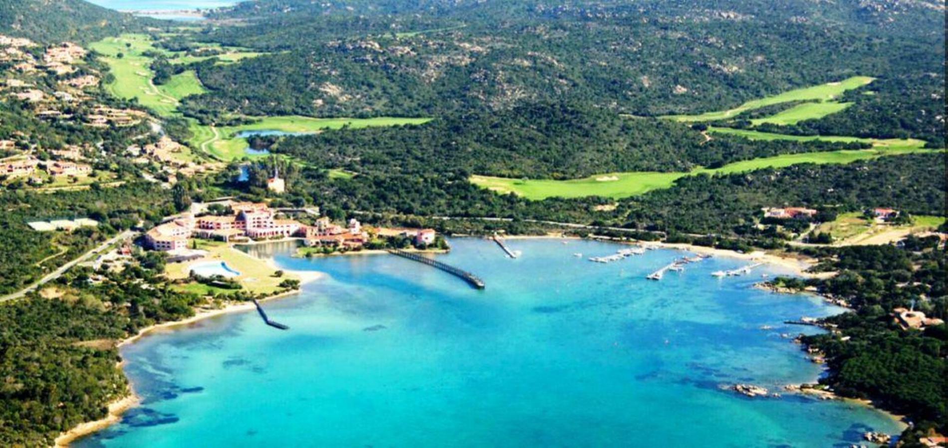
Costa Smeralda is one of the youngest destinations in Italy with the oldest clientele. Before 1961, it was a quiet, almost forgotten stretch of coast used for sheep grazing and fishing. That changed abruptly when a consortium of investors led by Prince Karim Aga Khan IV decided to invent paradise. And they did. The Consorzio Costa Smeralda was formed to strictly regulate development, ensuring architectural harmony with the landscape. Architects like Luigi Vietti laid out a master plan that banned billboards, neon signs, and high-rise buildings. Instead, they built a Mediterranean fantasy: stucco villas, winding roads, and discrete five-star hotels camouflaged by bougainvillea. Costa Smeralda today is an ecosystem entirely shaped by luxury tourism. Everything revolves around image, privacy, and control. But behind the designer eyewear and marble-clad bathrooms, there’s still a coastline of raw, almost overwhelming beauty. It stretches roughly 55 km along the coastline from the Gulf of Cugnana to the bay of Arzachena.
Costa Smeralda translates to “Emerald Coast,” a name not metaphorical, its waters are genuinely green-blue, so clean and vivid they look artificially rendered.

Porto Cervo
Everything with a name and a rank comes together at Porto Cervo. Everywhere you walk, you’ll find celebrities, luxury, boats, and large cars. Life is wonderful in the Costa Smeralda capital. Porto Cervo isn’t a city. It’s not even a town in the usual sense. It’s a spectacle. A microcosm of wealth, exclusivity, and summer escapism built from scratch. Porto Cervo sits about halfway between Olbia and Palau, on the northeast coast of Sardinia. Olbia’s airport is about 30 kilometers away, and that’s the gateway for most travelers. You can drive in from there in under 40 minutes. There’s a marina. Technically two. The “old” one is charming. The “new” one is massive, one of the best-equipped and most expensive in the Mediterranean. Superyachts are the norm.
The permanent population of Porto Cervo is roughly 400 people. But in the high season, tourist numbers spike to 30,000. These aren’t backpackers. These are hedge fund managers, fashion moguls, Instagram stars, Saudi royals and tech bros. The prices reflect that. A coffee can cost €10. A villa, millions. And a hotel suite… Better don’t ask. Paparazzi don’t swarm here as aggressively, and yet the guest lists are insane. It’s a hub for the ultra-rich to show off their toys – yachts, cars and watches. The price per square meter in Porto Cervo can exceed €30,000, among the highest in Europe. The Billionaire Club, founded by Flavio Briatore, is one of the most infamous nightclubs in the world. It’s not about dancing. It’s about being seen.
Every September, the Maxi Yacht Rolex Cup turns Porto Cervo into a nautical battlefield of elite sailing vessels. The Costa Smeralda Consortium still controls most of the land and aesthetic regulations. You can’t just build anything. It has to fit the vision.
Gennargentu
Gennargentu is the untamed roof of Sardinia. It’s the highest mountain range on the island, and spans across its central-eastern part, primarily in the provinces of Nuoro and Ogliastra. Punta La Marmora, with its 1,834 m, is the island’s highest peak. There’s snow here in winter, believe it or not. There’s even a micro ski resort near Fonni. This region is isolated, gloriously
- Public transport is sparse, and you’ll need a car. The roads are winding, often hair-raising.
The Gennargentu National Park protects a staggering array of biodiversity. Mouflons roam the slopes, golden eagles soar overhead and wild boars grunt in the underbrush. From Cagliari, it’s a two to three-hour drive on twisty and dangerous roads. That’s part of the experience. It’s not a place you visit casually. The journey is the price of entry. You earn it.
The villages of Gennargentu are isolated, almost deliberately cut off from the rest of Sardinia. The most famous of them is Orgosolo. For decades it was known as the “village of bandits.” In the 20th century, kidnappings and vendettas made headlines. The Italian government once considered it practically ungovernable. But that’s not the whole story. Orgosolo is also one of the most culturally alive places in Sardinia. It’s famous, internationally, for its murals. Hundreds of them.
Painted on houses, shops, walls and doorways. They started in the 1960s, first as political graffiti, later evolving into full-blown street art. Today, they’re a living gallery of protest, memory, and pride. Some commemorate world events, others mourn local injustices or celebrate Sardinian traditions. The art here doesn’t ask permission. It says what it wants, how it wants.
La Maddalena
La Maddalena is a dispersed group of granite islands located in the clear blue seas of the Mediterranean, off the northern coast of Sardinia. The La Maddalena Archipelago consists of seven major islands and dozens of smaller islets, all part of a protected national park. It’s a place of stone and light, cliffs softened by Mediterranean sun, wild herbs scenting the air, and endless shades of blue reflected in calm, crystalline bays. Geologically related to the pink granite rocks capes of Gallura in the northeastern part of Sardinia, the Maddalena islands are just 20 minutes away by ferry from the Sardinian port of Palau. However, these islands have just lately started to learn about tourism, and travelers have only recently learned about them.
Though less busy than the Costa Smeralda, this archipelago is nonetheless a favored destination for many tourists visiting Sardinia. It’s a world shaped by salt, time, and a quiet kind of pride. The main island, also called La Maddalena, is home to a charming harbor town, with colorful facades, small piazzas, and cafés that lean into the late afternoon sun. A bridge leads to Caprera, an island with pine trees, beautiful beaches, and hiking paths that overlook quiet bays occasionally visited by dolphins. Giuseppe Garibaldi, Italy’s national hero, spent his final years on Caprera. His house remains, still surrounded by olive trees and silence. It’s now a museum, filled with the belongings of a man who helped shape modern Italy but chose to die alone. Many people come to La Maddalena for its beaches, which never let them down.
Coves like Bassa Trinità and Cala Spalmatore on the main island have beautiful sand and clean,shallow water that make them perfect for swimming and peaceful days. Cala Coticcio, which is accessible by trail on Caprera, rewards the effort with smooth white rocks and dreamlike blue water. The tourism has grown, especially in summer, but the archipelago has retained its character. Much of that is due to its national park status. Development is limited and conservation is key. The result is a place that welcomes visitors without losing itself.
Most travelers landing in Sardinia by air or sea will first step foot in Olbia, but don’t be too quick to grab your rental car and speed north. Sitting in the Gallura region,
Olbia
Olbia is more than coordinates. It’s a natural harbor, and a launchpad to the glam of Costa Smeralda and the inland charm of Sardinia’s granite hills. Its position is strategic,really strategic. Ferry port, airport, highways. Everything feeds into it. The Olbia Costa SmeraldaAirport connects the city to mainland Italy and the rest of Europe. It’s one of the threemain Sardinian airports and the busiest during the summer.
The port is a key maritime hub, especiallyfor tourists arriving by ferry from Civitavecchia, Genoa, and Livorno. Roads like SS 131 and SS 125 slice across the region, linking Olbia to Sassari, Nuoro, and beyond. Sardinia isn’t famous for rail, but Olbia’s station still keeps trains alive. The city’s name is Greek. It means “happy” or “blessed.” Tourism numbers fluctuate, but Olbia pulls in roughly 3 to 4 million visitors per year, especially during high season. Many don’t even sleep there. They pass through on their way to the Costa Smeralda. But more and more are staying. The old town is compact and walkable, centered around Corso Umberto I, the main pedestrian street, and stretching inland toward a few quiet piazzas.
It’s not a perfect dream resort. It’s a soulful, functional city. Sure, you get beaches. Markets, Roman ruins, little trattorias, dusty museums, and stone churches are all included. There are ferry horns, espresso shots, and dialect-speaking residents. This town is the opposite of sterile.
Olbia might be a port city, but it’s also one of the best beach bases in Sardinia. Within 30 minutes, you can reach over a dozen beaches, each with its own character – family-friendly, wild, windy, soft-sanded, or stone-fringed. The local beaches often rank among the cleanest in Italy. Most of them are reachable by car, some by bus, and Tavolara by boat. Castelsardo
On Sardinia’s northern shore sits the charming medieval village of Castelsardo. Castelsardo’s location makes it an excellent stop on a journey between western Sardinia and the islands andresorts in the east. The old town, which is fortified with a castle, is an interesting and poetic spot to explore. The town was founded by the Genoese Doria family around 1102, back when Sardinia was a geopolitical mess of local judges, foreign interests, and sea raiders. When the region became part of the Kingdom of Sardinia, and eventually the unified Kingdom of Italy, the town got its current name: Castelsardo – a nod to both its castle and its island identity. Castelsardo is an attractive spot that is ready to receive and benefit from day-trippers.
Shops selling a variety of Sardinian handicrafts and other items can be found in old lanes, as can charming restaurant settings. A tourist bureau is set up close to the castle. The tourist area is still located within the old city walls on the headland, while the workaday, traffic-heavy portion of town spreads out across the saddle of land under the citadel. Today, the town’s few hotels are located just down by the sea. The town is also famous for basket weaving, a tradition passed down through generations. Several times a day, a local town bus travel to the castle, around town, and to the neighboring beach resort. This might be useful to guests.
The climb up to the castle, which is either zigzag or steeply up an alley and stairs, is exhausting, especially on a humid day. But the hike is worthwhile, since the beautiful old town is completely different to the modern town spread below.
Dunes of Piscinas
Hidden on the southwest coast of Sardinia, far from the noise of mass tourism, lie the Dunes of Piscinas – a surreal, sunbaked landscape that feels more Sahara than Mediterranean. It’s a shifting, golden sea of sand that rises from the emerald waters of the Mediterranean and rolls inland like a desert caught dreaming of the ocean.
This region is part of the larger Sulcis-Iglesiente area, known for its beauty and post-industrial ghost towns from a now-defunct mining era. No public transit gets you all the way. You’ll pass old mines, goat herds, maybe a dust storm or two. There are no trains. The last few kilometers are often gravel or unpaved roads.
Welcome to the wilderness. Once here, you’ll meet hikers, geologists, off-the-grid travelers, and people who really hate crowds. These are among the tallest active sand dunes in Europe. Some reach up to 60 meters high. Formed by centuries of wind-driven sand from the coast, the dunes stretch inland for several kilometers, swallowing pine groves and juniper bushes. The entire area spans over 30 square kilometers. Piscinas beach is wide, long, and powerful. The waves can be intense. Swimming here isn’t for the faint-hearted, but it’s unforgettable.
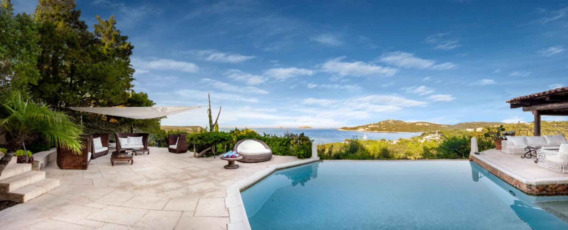
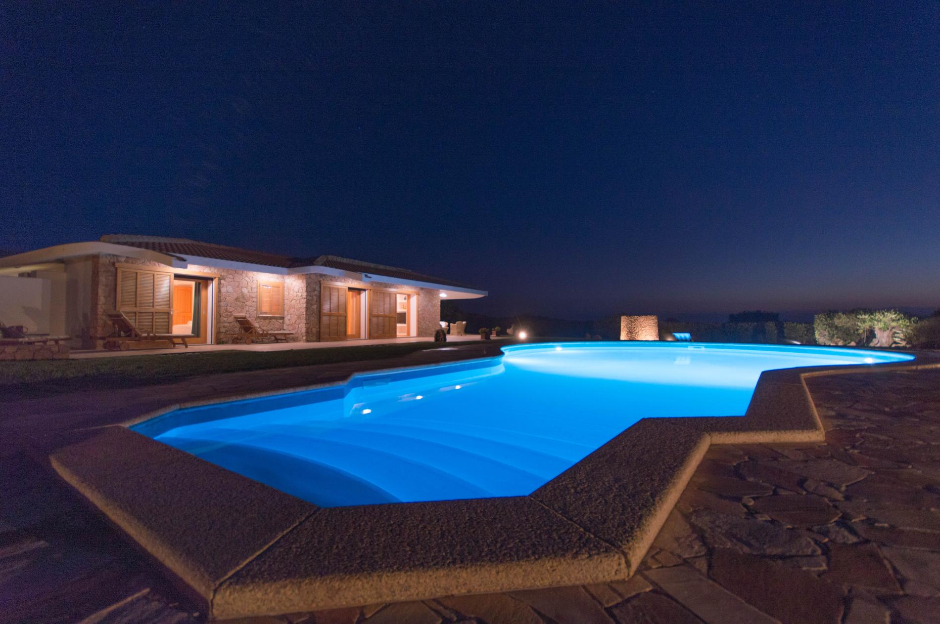
For the Villa please have a look under Accommodation at Luxury Villas Sardinia